Scarborough Bluffs could finally be open to the public
A major city planning project is exploring how to make one of Toronto's most dramatic geological features accessible while protecting its fragile cliffs.
The day's top stories, food & events — every morning at 7. Unsubscribe anytime.
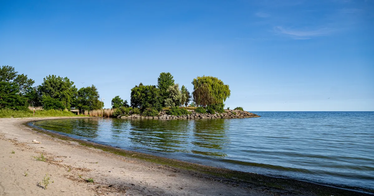
The Scarborough Bluffs stretch roughly 15 kilometres along Lake Ontario's edge, their clay cliffs glowing orange and red in the summer sun. They are one of Toronto's most striking geological features — and one of its most inaccessible.
Large sections remain difficult or outright dangerous to reach. Steep slopes, erosion, and limited formal access points have kept the water's edge largely sealed off from the public. Now, a major planning initiative led by the Toronto and Region Conservation Authority in partnership with the City of Toronto is exploring how to change that.
Through the Scarborough Bluffs West Project, city planners are weighing options that could bring new trails, shoreline protections, and public spaces to the stretch between the Eastern Beaches and Bluffer's Park. The study area covers approximately 4.5 kilometres, from Kingston Road down to Lake Ontario and west from Silver Birch Avenue to Brimley Road.
The project's scope is ambitious but carefully constrained. Planners are considering opportunities to improve how people access and move through the waterfront, preserve and enhance the natural environment, and minimize hazards caused by ongoing erosion. Some combination of elements could appear at the top and toe of the bluffs: aquatic and terrestrial habitat enhancements, new or enhanced access points, multi-use trails, public spaces, and shore protection works.
"The Scarborough waterfront has been the subject of over five decades of planning, studies and analysis seeking to understand stressors on the ecosystem, public access issues, and the nature of public safety and property risks posed by shoreline erosion," the project's environmental assessment notes.
The city and TRCA initiated a study on the area in 2021, which identified Scarborough Bluffs West as a priority project to "address remaining risks to public safety and property and explore the viability of a waterfront trail connection." That study highlighted a fundamental inequity: the Scarborough Bluffs are an iconic feature of the Lake Ontario shoreline, yet "due to limited access and existing public safety hazards, the water's edge along this section of the waterfront is not equitably accessible to the public."
For Torontonians who've hiked the Bluffs informally — scrambling down eroded slopes, navigating loose terrain — the need for formal access is obvious. The Bluffs draw photographers, naturalists, and locals seeking that raw geological drama. But the current state is precarious: each year the cliffs erode further, each season loose soil shifts underfoot.
The project is now in its third round of public consultation. Nearby residents and frequent visitors are invited to complete an online survey before June 30. The consultation process is meant to gather community input on what access looks like, what protections matter most, and how to balance public recreation with environmental stewardship.
If the planning moves forward, formal trails and access points could transform the Bluffs from a secret scramble into a sustainable waterfront destination — a place where Toronto residents can experience one of the city's most dramatic natural features without accelerating its decay.